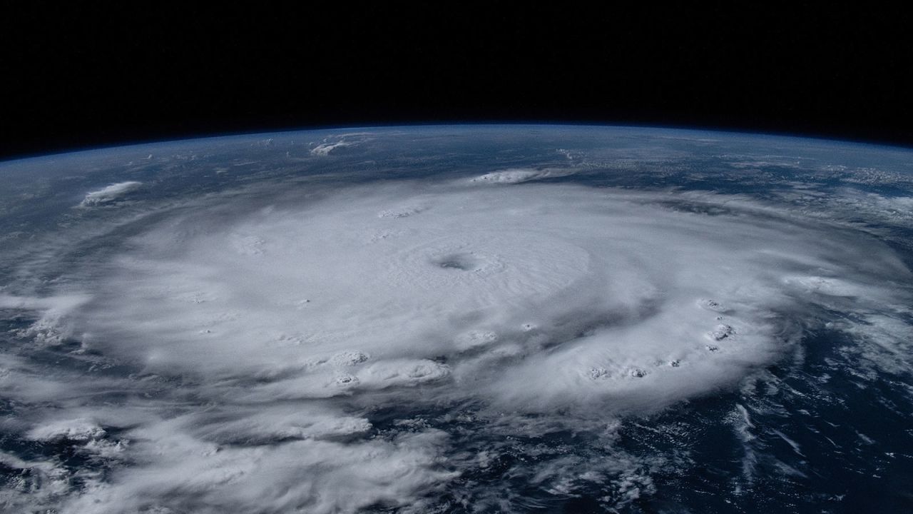


Beryl just smashed all expectations of what an early season hurricane could become, and it has experts concerned for what could be coming next.
Typically, early season storms aren’t indicative of what’s to come later in the season because the necessary atmospheric conditions for powerful storms aren’t yet in place. But Beryl broke the mold.
“Normally, early-season storm activity doesn’t tell us much about what is going to happen the rest of the time,” Phil Klotzbach, a hurricane expert and research scientist at Colorado State University, told CNN. “But when storms are strong in the tropical Atlantic and eastern Caribbean, it tends to be a harbinger of a very busy season.”
The busiest part of Atlantic hurricane season doesn’t typically begin until mid-August and peaks in September, but Beryl – which initially formed in late June – behaved like it already arrived. The water Beryl raced through was as warm as it should be in September, so it behaved like a September hurricane.
It’s something forecasters warned could happen even before the season got underway.
“Beryl confirms what we thought about (this) season, that given the extremely warm (water) temperatures that we currently have, we could experience mid-season-type storms earlier than normal,” Klotzbach said.


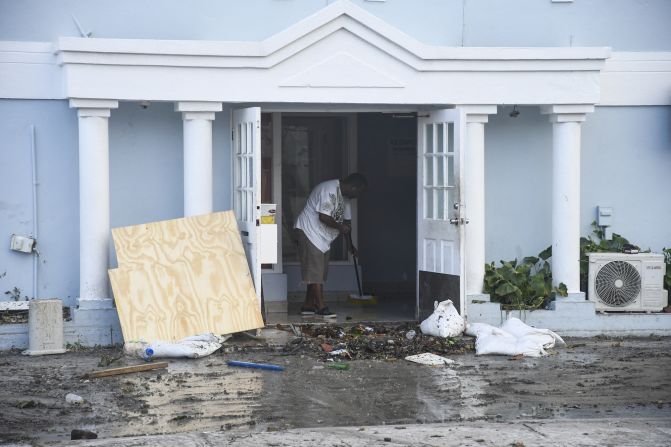


In pictures: Record-breaking Hurricane Beryl
Ocean temperatures in the Atlantic basin remain historically warm and have been for more than a year, particularly where Beryl first became a hurricane. Warm oceans are a major consequence of a world warming due to fossil fuel pollution and provide the fuel for tropical systems to explode in strength at a breakneck pace.
Beryl rapidly intensified faster than any other storm on record this early in the season when its winds increased by 65 mph in just 24 hours, according to Klotzbach. Rapid intensification is becoming more likely as the climate crisis advances.
“Beryl’s early and rapid intensification is indicative of the types of extreme weather events we may see more frequently in a warming world,” according to Mona Hemmati, a postdoctoral research scientist at Columbia University’s Climate School. Beryl “encapsulates many of the fears scientists have for this hurricane season,” Hemmati told CNN.
The storm took advantage of extremely warm waters and eventually strengthened into the Atlantic’s earliest Category 5 hurricane on record – one of several milestones no other early July hurricane has reached.
Forecasters increase hurricane season predictions after Beryl
Beryl’s unprecedented performance only solidified a chorus of expert voices – including Klotzbach’s team at Colorado State – who called for a hyperactive hurricane season well before the first three named storms – Alberto, Beryl and Chris – formed.
“This early season activity is a likely warning sign that things are going to be very busy once we move closer to the peak of the season,” Klotzbach cautioned.
Klotzbach’s group of forecasters at Colorado State increased the number of named storms, hurricanes and major hurricanes expected this season in an update to their hurricane season forecast Tuesday. They now predict the Atlantic season will have 25 named storms including 12 hurricanes, half of which will become major hurricanes of at least Category 3 strength.
The forecast also relies on a burgeoning La Niña that should ease wind shear – the change in wind speed or direction at different heights in the atmosphere – over the Atlantic. High levels of wind shear can tear apart an active storm or prevent one from forming in the first place. Without it, more storms could form and strengthen.
But extremely warm water will stick around through the peak of hurricane season and storms could take full advantage of it to overcome wind shear, just like Beryl did.
The extremely warm water kept Beryl incredibly strong, even in the face of disruptive wind shear that should have weakened it considerably. This also happened during last year’s hurricane season when El Niño brought increased wind shear but incredibly warm water still helped 20 named storms form.
For now, a brief pause in Atlantic tropical activity is expected over the next week or two due in part to a large area of dry, dusty air and some bouts of moderately disruptive wind shear.
Plumes of dry air filled with Saharan dust traveling across the Atlantic from Africa are typical around this time of year. It can sometimes even reach the United States and help produce stunning sunsets.

But dry, dusty air isn’t a friend to tropical systems. It cuts off the moisture a system needs to survive, so the National Hurricane Center isn’t highlighting any areas to watch for tropical development over the next week.
When the break will end and the busiest part of hurricane season will get underway is the “million dollar question,” according to Klotzbach. Tropical activity could ramp up again later in July or hold off until August depending on how several atmospheric factors play out in the next couple of weeks, he told CNN.
Either way, with such an extreme ocean heat to tap into, Beryl proved the door is wide open for a prolific season.
CNN’s Rachel Ramirez contributed to this report.